Agriculture & Water Resources
Crop Yield Forecasting
Using its AI/ML techniques for satellite image classification, Knowledge Spatial can predict well in time for any crop yield estimation. Crop health and its spatial extent are critical factor for this which can be mapped and monitor periodically.
Crop Insurance Scheme
In the event of some natural hazards, loss of crop can also be mapped parcel wise quickly, so that crop insurance companies/ govt authorities can easily assess the actual damage parcel/khasra level.

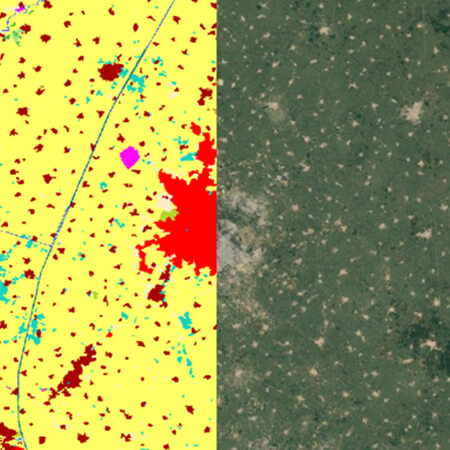
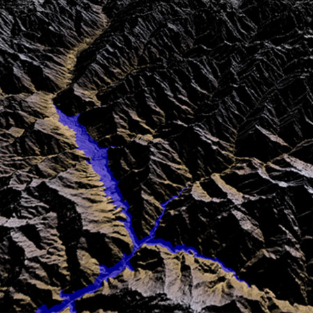
Water Resources
Water is a fundamental resource for human life. Its scarcity is increasing day by day in Indian Agricultural Land. Using Remote Sensing and GIS technologies it can be easily monitored, analysis of availability across the different season can easily be mapped and planned accordingly.
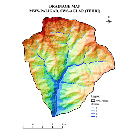
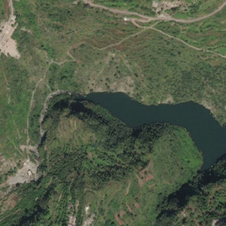
Site Suitability analysis for Hydro DAM
For identifying right location to construct new dam, is another important aspect where GIS can play very important role. Knowledge Spatial is well equipped to carry out such study and help authorities for planning and monitoring this critical resource.
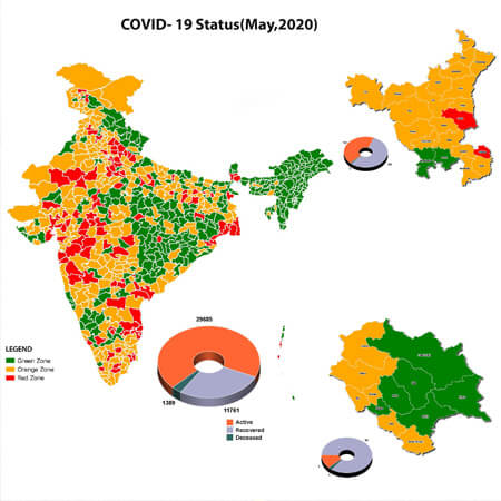
Forest, Environment & Climate change
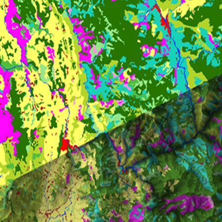
Land Use/Land cover mapping
Land Use/Land cover mapping is very effective for forest acreage mapping or its sub types. In Indian sub continent, most of the forest acreage is highly undulating area. So there is great need of surface area calculation of such regions to precise estimation of forest cover . Knowledge Spatial have developed its own application to calculate surface area of any region using Digital Elevation Model for the respective region.
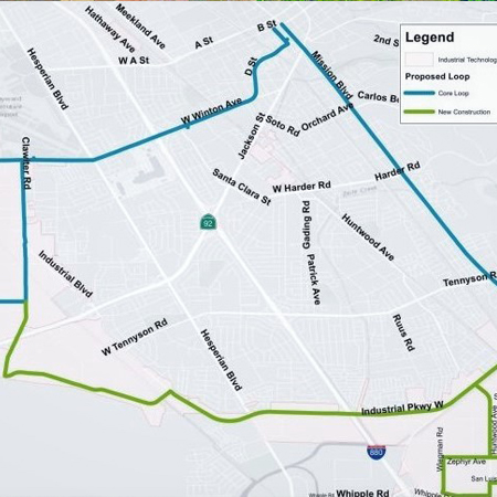
Infrastructure & Transportation
Large Scale Mapping
It is very important to understand geographical condition in its totality of any project area which is not possible without large scale mapping. Drone Mapping or high-resolution Satellite Imagery are very useful for this.
Remote Inventory Management
In large infrastructure projects, inventory management is a crucial factor and it has always to be keep in mind that inventory of all required material like cement, sand, dust and crasher etc should remain available all the time. Using drone mapping service on periodic basis, this can be monitored and ensure that an adequate supply should remain in place. Volume of inventory can be calculated using stereoscopic drone image.
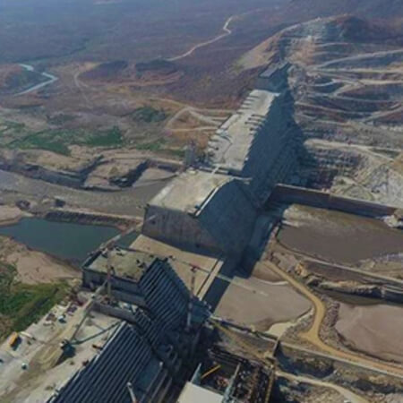
Monitor the progress of project
Periodic satellite images and drone mapping are quite helpful to monitor the infrastructure projects and their progress, which ultimately help to finish the work well in time and keep control on costing part.

Municipality & Smart City
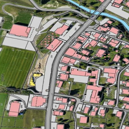
Base map creation
Knowledge Spatial develop and serve your own base maps for any particular theme or for any specific area of interest. These themes can be very particular in nature which demand detailed information for any particular theme like for planning perspective, cadastral mapping, utilities, facilities management, hydrology, demographics, geology or any other. Using satellite imageries or drone images detailed large scale land use maps can be created for any specific area. We extend our Base Map services to several urban local bodies.
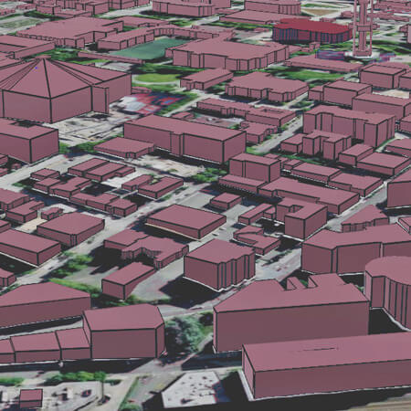
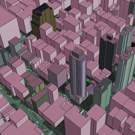
3D modelling
Cities are growing very fast in Indian Subcontinent. There are many reasons behind urban sprawl, including a desire to build improved infrastructure.
To minimize the negative impacts of urban sprawl and increased development, it’s important for city planners to carefully determine the best way to grow urban areas.
3D GIS can help city planners to visualize what their proposed changes will look like and predict the outcomes for current residents and future generations.
Health & Education
- GIS is very effective in plan & monitoring. It can help in
- Human Health Decision-making.
- Spatial observations can give early warning.
Plan and logistic support for vaccine program.

Planning and monitoring of contamination zone to full fill their basic needs.
Knowledge Spatial offers various training program at different level in educational institutes. Some of them, but not limited to, are
- Assistance in educational research program and capacity building.
- Assistance for introduction of spatial Technology as a curriculum for class XI & XII for CBSE schools under Skill India Program.
- Conducting Technology awareness program in different universities to bring awareness and effective use of GIS.

Utility Networks
Site Suitability Analysis for Mobile tower.
Cable Network digitalization
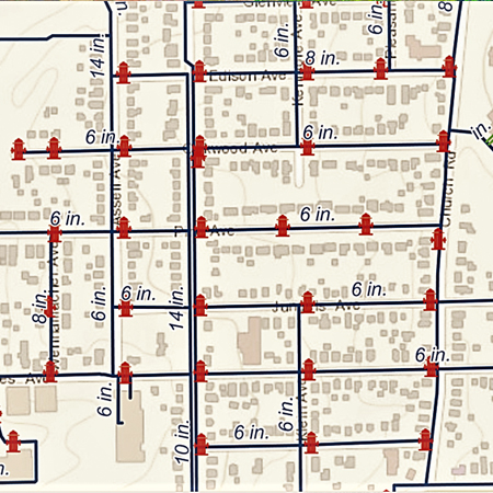
Drinking water supply and monitoring solution
Manufacturing & Services Industry
Knowledge Spatial can optimize manufacturing unit and their logistics with location technology. GIS can provide new in-depth information to business which directly relates to locations, dealers, OEMs, and supply chain. GIS identify patterns of geographical information related to OEM, dealers, and supply chains. Applying geography to sales or demand data, market and consumer trends can easily be understood.

Location technology enables to
- Drive sales
- Clarify demand signals.
- Optimize your facilities and locations by
- Analyse your supply chain in real-time
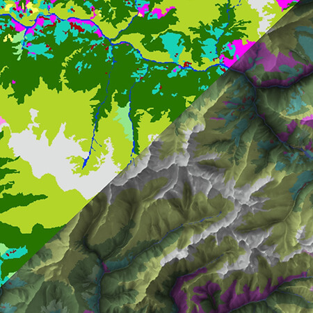
Defense & Homeland Security
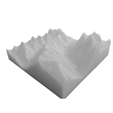
3D Terrain Model
3D Terrain Model on the scale of 50k, of any interest area, which gives every minute details of terrain. Very helpful for operational planning.
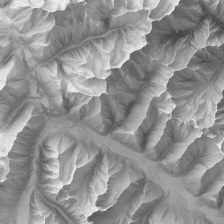
True Terrain Relief Map(TTRM)
True Terrain Relief Map(TTRM) is next generation relief map which have been created using advanced technology. Gives a realistic picture of terrain of any area. Can be zoomed to a scale of 5000 to know every details of locality. Also, Can be used as backdrop layer to depict the realistic picture of any highly undulating area.
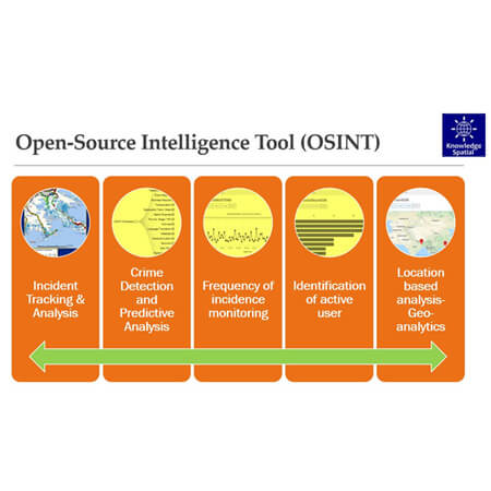
Open-source intelligence (OSINT)
OSINT works in different modules, some prominent of them includes
- Incident Tracking & Analysis
- Crime Detection and Predictive Analysis
- Frequency of Incidence monitoring
- Identification of active user
- Location based analysis.
Surface Area Calculation
Surface Area Computation Solution (SACS) is custom application developed for computation of surface area or distance in high terrain area. This brings more realistic picture for planning perspective. In Ops room, it can be very critical point while working on any strategic planning.
Custom Services
- 3D Analysis
- Site Suitability Analysis
- Navigation and Optimized Route Planning